The first time I saw a spring was the first time I fished with my friend Erick Johnson. He brought me to his favorite bend on a famous northern Michigan river, where he showed me a muddy depression covered in pine needles. He swept them aside to reveal a small dark pool of cold, clear water, watercress-framed, into which he sank a pair of stubby Coors bottles. Later, after a decent spinnerfall and a few good trout at last light, we drank those numbingly-cold beers on the bank, listening to the fish, still rising in the dark.
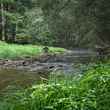
Later I got to know spring creeks in Minnesota’s Driftless region. On my first trip there, I remember seeing a three-inch brook trout in a stream I could step across, seemingly hovering in the air-clear water. Next to it, a small plume of sand percolated. Mineral-rich groundwater, filtered through the ancient limestone hills all around me, was bubbling into the stream right there. The trout finned around and through it. Fontinalis — of a spring — indeed.
I was thinking of springs, spring creeks, and their magic one dry, hot day this summer. I stood on the edge of the Medicine Lake Volcano’s lava dome in northern California, which, despite its appearance, is a unique and immense landscape-level groundwater system.
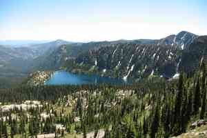
Behind me was dark Ponderosa pine forest, mature and open, sighing in the afternoon citrus-scented thermal. In the distance glinted the snowy cone of Mount Shasta, rags of cloud streaming from its peak like pennants. Before me, a lunar-looking lava bed descended gradually southward, dotted here and there with clumps of manzanita, solitary towering sugar pines, and gnarly California incense cedars. The afternoon sun shimmered and bloomed the rock’s black-gray palette into subtle orange and cream colors.
Lying unassumingly between its conical neighbors, Mount Shasta and Mount Lassen, the Medicine Lake Volcano is a shield volcano, named after the lake within its caldera. Its periodic eruptions over the eons have created nearly 850 square miles of gently-sloped lava beds, layered on top of one another, making it the Cascade Range’s largest volcano by volume. This unique structure is collectively called the Medicine Lake Highlands, and is the secret behind the region’s critical hydrology.
I was there as part of a tour group hosted by Trout Unlimited and Backcountry Hunters and Anglers in support of a campaign to have the Medicine Lake Highlands, now primarily referred to as Sáttítla, designated as a National Monument. The campaign was launched in 2023 by the Pit River Tribe, to whom the Highlands — or Sáttítla, as they call it — is ancestral home, and they’ve been fighting in court to protect the area from geothermal exploitation for decades. TU, BHA, and CalTrout have added their voices to the campaign, recognizing the natural and cultural resources at stake.
Lava cobble crunched underfoot, resonating like broken glass. I stooped to examine one: lighter than expected, its surface porous like a ferrous sea sponge. Sharp edges caught my fingertips. A geologist would call this ʻaʻā lava: the shattered crust of a slow-moving lava flow's cooling surface. So far, moisture had felt conspicuously missing. No bounding mountain streams, no perched bogs or fens, no muddy elk wallows. None of that rushing gray-blue meltwater that so many other mountains shed through the warmer months.
I joined the group at the rim of a swimming-pool sized pit, an ovoid hole punched in the lava’s surface. Angular rubble, the remnants of what had been the roof of this lava tube, formed a ramp of sorts at one end of the pit. At the other yawned a black cave opening.
As we carefully clambered down into the cave, the air cooled dramatically in a perceptible gradient. It smelled like the inside of a clean walk-in freezer. Wet patches of green moss glittered on the cave walls. Another pile of rubble blocked the tunnel after about twenty yards, and at the very bottom, anchoring the stones like the toffee part of peanut brittle, was a thick layer of opaque white ice.
How surreal, we remarked to each other, to feel that cold damp, and to see solid ice just a few steps from the dry heat of northern California. But ice caves like this are not uncommon in shield volcanoes: simple cold-air sinks, insulated and protected from air currents by the lava tube, where cold winter air lies undisturbed through the summer months. That ice was the clue: a moment of passing water, frozen in time. A snapshot of an otherwise hidden process.


The Medicine Lake lava dome is a colossal sieve. Rain and snowmelt doesn’t run off it in rivers or creeks, but instead filters downward into the rock and slowly migrates down-slope, generally south and west, toward the Fall River Valley. A billion underground trickles, following mysterious and invisible fissures, seams, and layers — at any given time there is an estimated 20 to 40 million acre-feet of water stored here. That’s more water than California's 200 largest man-made reservoirs combined.
This reserved water is meted out steadily along a 10-mile long groundwater discharge complex known as the Fall River Springs. These springs are the primary source of the Fall River, which is California’s largest spring creek, and boasts some of the highest trout density in the state.
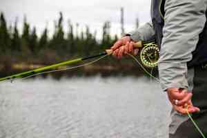
The next morning, we fished it. The river’s banks are largely privately owned, so it’s fished with guides from small motor skiffs, a fact with which I was reckoning a bit — on one hand, the chance to fish exclusive, ecologically-rich water is exciting; on the other, some of the magic of discovery is lost when you can’t explore in your own wading boots.
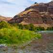
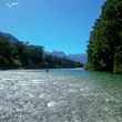
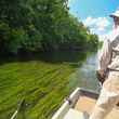
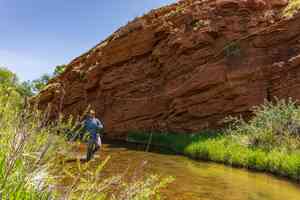
But our guides, with Confluence Outfitters, were professionals who knew the river, and the magic soon returned as we motored upstream. In classic spring-creek fashion, there were no rapids or pools, but instead a gentle meander between grassy banks. Shasta and Lassen gleamed in the hazy distance, but I barely looked up. Instead, I gawked over the bow at the emerald-green spring water, undulating mats of weeds, a heavy sprinkling of emerging PMDs, and thousands of trout. They scooted off sand flats and out of weed pockets by the dozens. Not infrequently, a two-plus-footer would sulk out of the way as we drifted over. On some outside bends, 40 or 50 snouts dimpled the water as if a pretty heavy rain were falling.

Our guides had us swinging wet flies into these pods from upstream. We caught a few and lost plenty. I had one heavy fish grab my fly and thrash on the surface just long enough for me to realize it would have dwarfed any Great Lakes steelhead I’d ever caught — and then the 6X tippet let go.
Amid the harsh montane and volcanic landscape, the Fall River Valley is an oasis. The pastoral fields, the thick grassy banks, the fish and insects — it seems to be almost furiously alive. The water itself, impossibly-blue-green, didn’t seem to flow downstream, it surged. There are no cataracts or waterfalls, no dramatic bouldery runs; just a steady inexorable push of clear, volcanic spring water.
As much as 1.4 million acre-feet of water pour from the Fall River Springs complex annually, and isotope studies of the various sources have shown the water’s age in some to be only 12 years old, while others are discharging water that fell as snow over 40 years ago. This slow and varied movement of groundwater makes the Fall River Springs reliable, even in extended periods of drought.
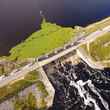
The Fall River’s flow is added to that of the Pit River, and its year-to-year reliability generates as much as 13% of California’s hydropower. The Pit then empties into the Shasta Reservoir, which then becomes the Sacramento River — another classic trout water — a lifeline that stretches from the volcanic highlands all the way to San Francisco Bay. The water supports diverse ecosystems, provides habitat for native trout and salmon, sustains agriculture in the fertile Sacramento Valley, and contributes to the drinking water supply for millions of Californians.

The Highlands themselves are a spectacular landscape, worthy of protection on their own merit. Medicine Lake itself, which sits within the volcano’s caldera, has been a spiritual center for local tribes since prehistory. There are also pumice fields in which Apollo astronauts trained for moon landings; a massive obsidian formation known as Glass Mountain; and countless ice caves and lava tubes. The unique forest-over-lava ecosystem supports a long list of threatened and endangered species, to include the gray wolf and spotted owl. Undeveloped wild places like this, especially those at higher elevations, are increasingly rare and critical in a warming West.
It’s within this context that Monument designation for the Medicine Lake Highlands makes sense. Geothermal power exploration is the primary industrial threat, largely because of the hydraulic fracturing involved. The precious groundwater in that porous rock would be at risk of contamination by not only toxic fracking fluids but also naturally-occurring toxic volcanic compounds that the fracking would likely release. For now, the Pit River Tribe’s tireless efforts to block geothermal exploration has all the current major projects stalled.

And there are no other entrenched extractive industries to confront, no communities fearing economic loss. This is a unique chance to protect a vital resource and valuable landscape without controversy — before crisis forces a fight. With changing political winds, energy needs, and technology, the Highlands are under threat as long as the land remains open to mineral and energy exploration.
The Highlands exist within parts of the Klamath, Shasta-Trinity, and Modoc National Forests, and its resources are managed by both the Forest Service and Bureau of Land Management. Monument designation would not change any land ownership — it would all remain federal public land — but it would help prevent new mineral or geothermal leases, and eliminate the possibility of land transfers out of federal ownership. A management plan won’t be created until after designation, but under the purview of the Forest Service and the BLM, public access to and use of the land, to include hunting and fishing, would almost certainly remain unchanged.
Ahjumawi Lava Springs State Park was the last stop on our tour. After boating across Big Lake — the only access to the park — we hiked along the shore with members of the Ahjumawi Band of the Pit River Tribe, who lived in the area for thousands of years. They showed us how they’d used rock fish traps to catch the native rainbow trout and Sacramento suckers that they’d depended upon forever.

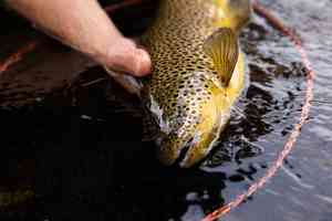
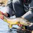
And they showed us the springs. At the head of an unassuming channel, overgrown with rabbit brush and willows, turquoise-tinted crystal-clear water surged from beneath a rock ledge, pouring over time-worn lava rubble. This was no beer-cooling seep, nor limestone-creek trickle. More water was pouring from this single spring than the entirety of some of my favorite spring creeks back home. In an inches-deep eddy to one side, glinting in overhead sunlight, a six-pound rainbow trout hunted amongst the lava boulders.
It had seemed counterintuitive that most of our tour time was spent outside the boundaries of the proposed monument. Neither the Fall River Valley, Fall River Springs, nor Ahjumawi State Park are within it. From the wooded shore of the lake, we couldn’t even see the lava of the Highlands. Yet here was its water, pouring from the living rock, cold and drinkably clean, perhaps having fallen as snow on top of a volcano before I was born, and relied upon by countless downstream ecosystems and people.
Now is the time to protect it, and presidential designation as a National Monument is the right way to do it.
For more information on the campaign to protect the Medicine Lake Highlands through National Monument Designation, you can visit Trout Unlimited or Protect Sáttítla.











Comments